Mapping The Midland
I recently shared a “then & now” post showing a historic map of Manchester, with today’s buildings overlaid on an 1849 plan.
These overlays are never perfect. Maps from different periods don’t always line up neatly, and over distance even a small inaccuracy can become quite noticeable. But they’re still a brilliant way of seeing how the city has evolved.
One discrepancy, though, really bothered me.
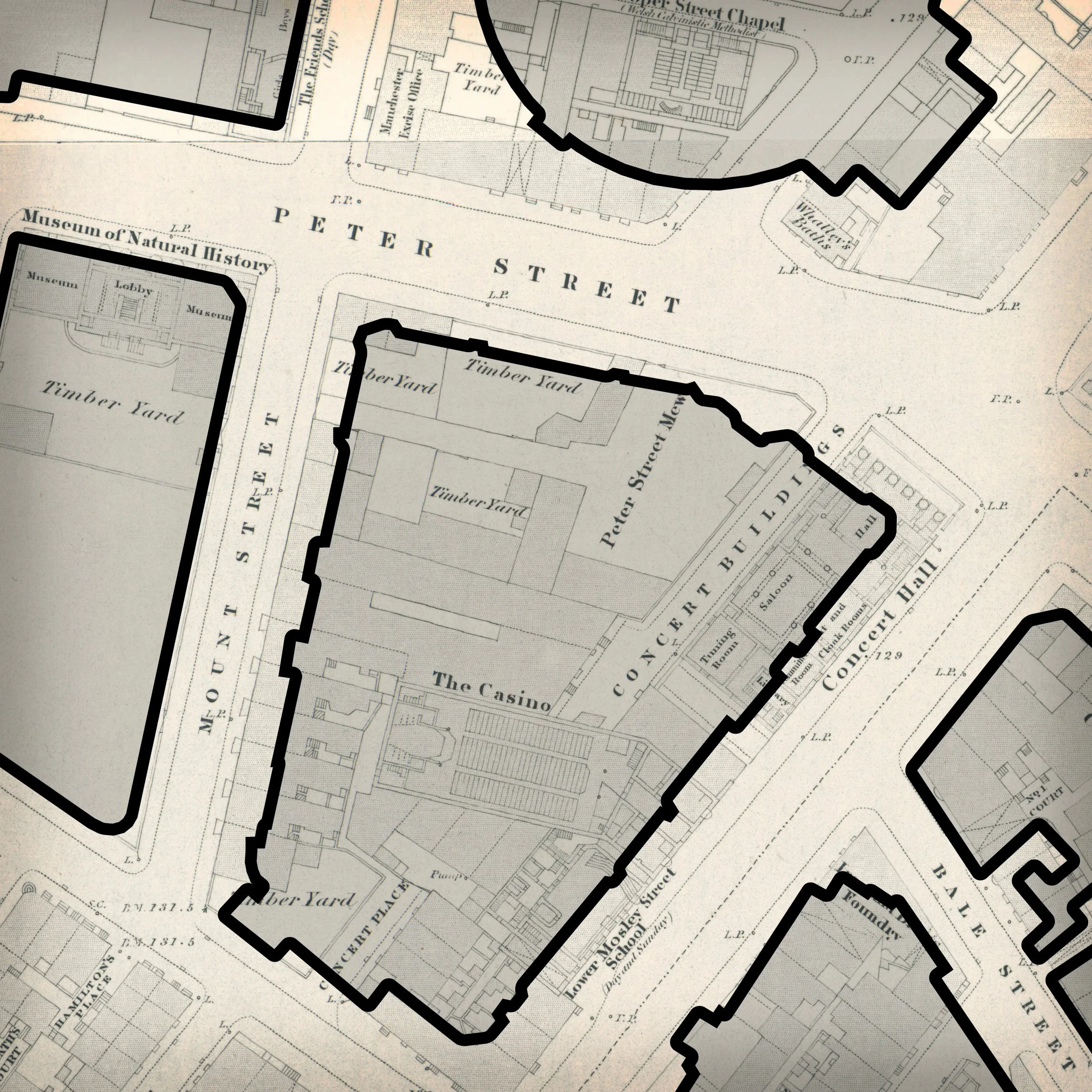
The map seemed to show the old Gentlemen’s Concert Hall sitting partly beneath what is now the Midland Hotel… but the Midland appeared noticeably smaller than the block it replaced.
At first, I assumed this was probably due to planned road widening.
And it turns out… it was.
Digging through old records, I found this wonderfully satisfying explanation in The Builder, from 24 January 1903:
“It is about four years since the company [Midland Railway Company] acquired, at a cost of about £65,000, the land on which the new building stands, and cleared from it the Gentlemen’s Concert Hall, the People’s Concert Hall, the Lower Mosley-street Schools, and other buildings. Then, after the contracts had been let, there were delays on questions of street lines. Something like 2 yards had to be given up to all the four streets which surround the plot, so that the company’s area was reduced to about one and a third acres.”
So the map wasn’t wrong. Or at least, not as wrong as I first thought.
The Midland Hotel really was built on a slightly reduced version of the site, clipped back on all four sides to allow for the new street lines.
What looked like a mapping error was actually a trace of a planning argument from more than 120 years ago.
Which is exactly the kind of thing I love about digging into Manchester’s past: sometimes the interesting story is hidden in the bit that doesn’t quite line up.
The Midland Hotel features in my Introduction to Manchester walking tour.