Yesterday’s Google: Reading Manchester Through Old Maps
I absolutely love looking at old maps.
There’s something fascinating about comparing the Manchester we know today with the one that used to be there… the lost streets, old building lines, former uses, and tiny clues that explain why certain places feel the way they do.
The Goad maps are especially brilliant.
These were fire insurance plans, produced to help assess fire risk in urban buildings. But they don’t just show streets and building footprints, they often label building uses, materials and other details that help bring the historic city back to life.
In some ways, they almost feel like a Victorian version of Google Maps. Once you get your eye in, you can start recognising places that still exist today - while also spotting just how much has changed.
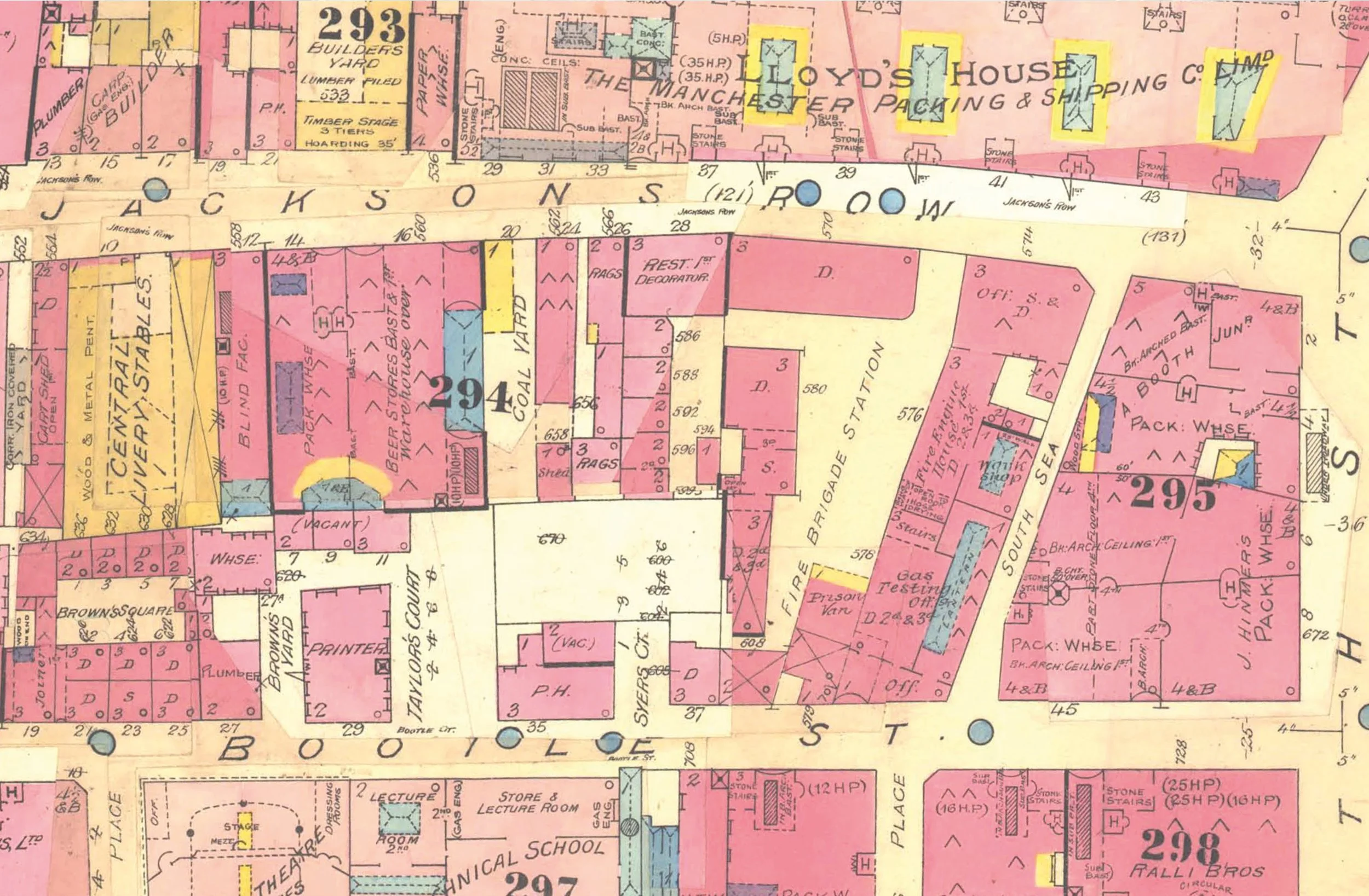
This extract, from August 1886, shows the area around what is now the St Michael’s development, between Bootle Street and Jackson’s Row.
The Sir Ralph Abercromby is shown, although not named as such, but clearly marked as a public house. Next door, in what later became the police headquarters, is shown as being a Fire Brigade Station.
Cutting through this block was a street called South Sea…!
This was proper industrial Manchester: dense, practical, messy, and full of places where things were made, stored, moved, sold and drunk.
That’s what I love about this particular series of maps. They don’t just show the layout of the city, they show its personality.
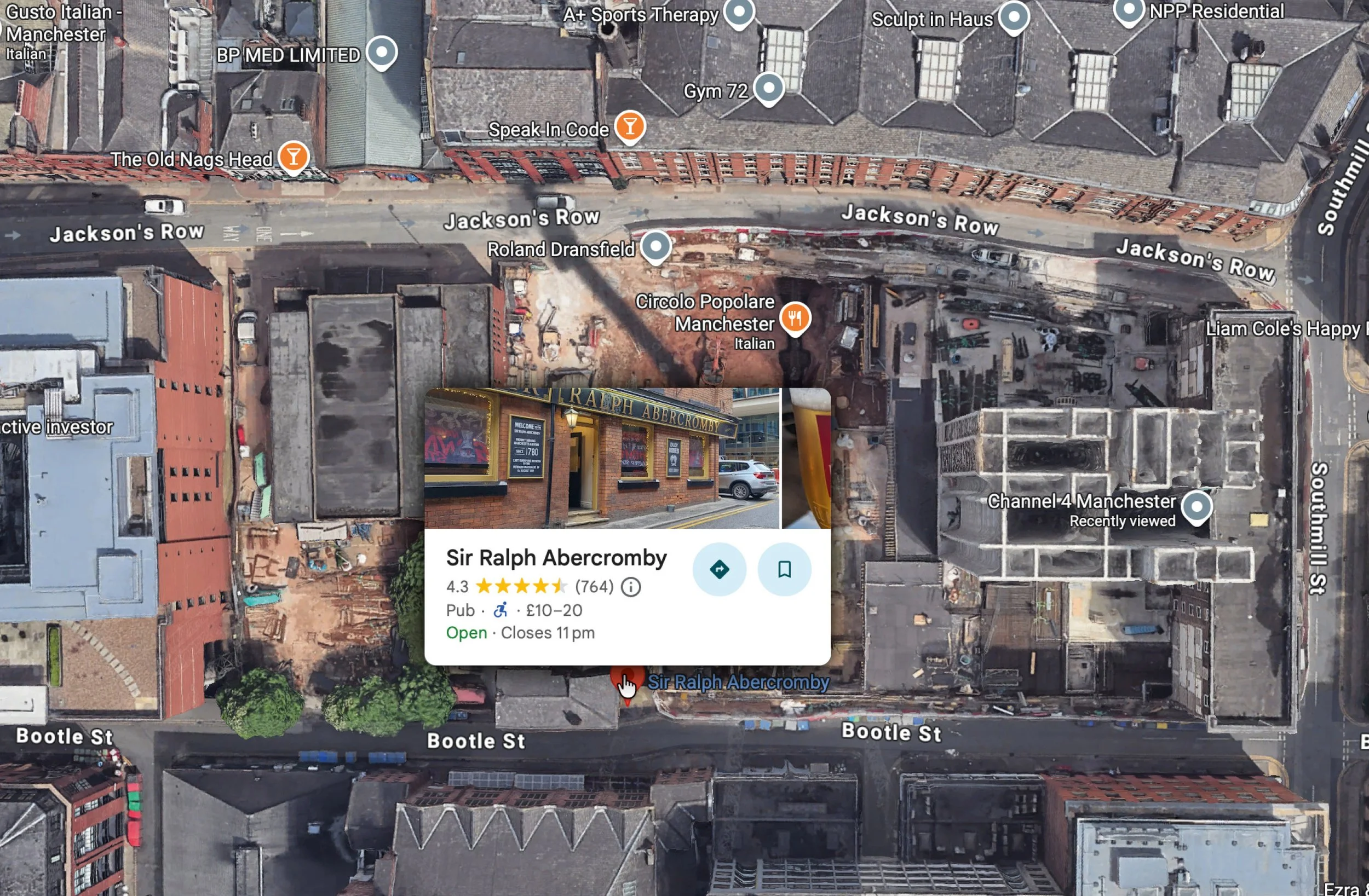
Compare that with the modern map, where the same area is now dominated by St Michael’s, new offices, posh restaurants, legal services, gyms, a 5-star hotel and Channel 4’s Manchester base.
Manchester’s personality has certainly changed…!!
What differences can you spot?